.
vessel Fernandina IMO: 9353620, Bulk Carrier
vesseltracker.com
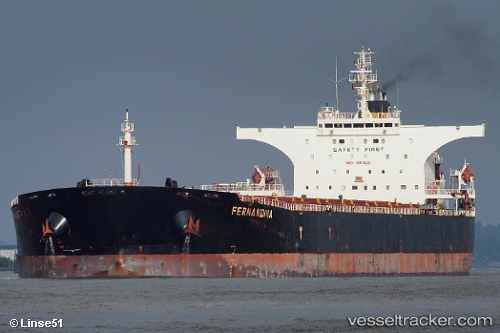
Vessel Fernandina IMO: 9353620, MMSI: 256296000 Bulk Carrier

callsign: 9HQP8
size: 45x289

Live AIS position: UTC. Near ZAANDAM), updated 2022-11-23 15:46:56 UTC.

Find the position of the vessel Fernandina on the map. The latter are known coordinates and path.

marine traffic ship tracker show on live map

The current position of vessel Fernandina is 52.41308 lat / 4.81737 lng. Updated: 2022-11-23 15:46:56 UTC
Details:


Last coordinates of the vessel:
2022-11-23 15:46:56 UTC, 52.41308, 4.81737, course: 160, speed: 0

Track of the vessel in the last 28 days


Most frequent ports a vessels calls at Fernandina (256296000):

Sambu, traffic: 6
Istanbul, traffic: 4
Uskudar, traffic: 4
Canakkale, traffic: 3
Gelibolu, traffic: 3
Ayn Sukhnah, traffic: 2
Saldanha Bay, traffic: 2
Bur Ibrahim, traffic: 2
Singapore, traffic: 2
Taranto, traffic: 2
Richards Bay, traffic: 2
Ruch’I, traffic: 1
Constanta, traffic: 1
Skagens Odde, traffic: 1
Korsor, traffic: 1

Link to the map:


Find another ship

Fernandina (256296000) last ports (portcalls and passsages)

Amsterdam | 2022-11-21 17:56:07
Richards Bay | 2022-09-20 16:48:46
Richards Bay | 2022-09-16 16:30:31
Ras Gharib | 2022-08-08 02:18:14
Ayn Sukhnah | 2022-08-07 19:39:45
Port Said | 2022-08-07 07:22:33
Skagens Odde | 2022-07-23 13:26:21
Korsor | 2022-07-22 22:16:00
Ust-Luga | 2022-07-18 01:37:43
Ruch’I | 2022-07-17 19:02:27
Bur Ibrahim | 2022-07-01 04:29:55
Ayn Sukhnah | 2022-06-20 13:17:27
Bur Ibrahim | 2022-06-15 13:45:42
Canakkale | 2022-06-12 16:29:10
Uskudar | 2022-06-11 16:28:43
Gelibolu | 2022-05-09 10:15:51
Uskudar | 2022-05-08 13:39:30
Constanta | 2022-04-19 06:01:02
Uskudar | 2022-04-18 09:45:10
Gelibolu | 2022-04-17 12:09:18
Canakkale | 2022-04-17 09:50:01
Taranto | 2022-04-08 15:20:14
Saldanha Bay | 2022-02-23 06:30:07
Sambu | 2022-01-06 21:55:41
Singapore | 2022-01-06 21:06:13
Sambu | 2022-01-06 21:05:03