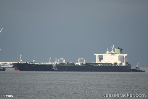
vessel Dream Ii IMO: 9356593, Crude Oil Tanker
vesseltracker.com
Vessel Dream Ii IMO: 9356593, Crude Oil Tanker
MMSI: 422204100 callsign: EPJB3 size: 60x333
Live AIS position: 1.81697° N, 104.80720° E UTC. 48 nm NE of PENGERANG), updated 2025-11-13 07:42:43 UTC.

Find the position of the vessel Dream Ii on the map. The latter are known coordinates and path.

marine traffic ship tracker show on live map

The current position of vessel Dream Ii is 1.81697 lat / 104.80720 lng. Updated: 2025-11-13 07:42:43 UTC
Details:


Last coordinates of the vessel:
2025-11-13 07:42:43 UTC, 1.81697, 104.80720, course: 29, speed: 12.2

Track of the vessel in the last 14 days


Most frequent ports a vessels calls at Dream Ii (422204100):

PENGERANG, traffic: 6
BATU AMPAR, traffic: 5
Sambu, traffic: 5
TANAH MERAH, traffic: 3
Singapore, traffic: 2
BUKOM ISLAND, traffic: 2
PULAU SAMBU, traffic: 2

Link to the map:


Find another ship

Dream_Ii (422204100) last ports (portcalls and passsages)

PENGERANG | 2025-08-17 13:26:31
TANAH MERAH | 2025-08-17 12:24:49
BUKOM ISLAND | 2025-08-17 11:16:23
BUKOM ISLAND | 2025-04-11 09:20:03
BATU AMPAR | 2025-04-11 08:08:27
PENGERANG | 2025-04-11 06:49:09
PENGERANG | 2025-03-16 23:32:10
BATU AMPAR | 2025-03-16 22:04:04
BATU AMPAR | 2025-01-26 15:52:01
TANAH MERAH | 2025-01-26 15:15:41
PENGERANG | 2024-12-21 21:20:28
BATU AMPAR | 2024-12-21 19:50:11
TANAH MERAH | 2024-11-11 11:37:29
PENGERANG | 2024-11-11 11:22:27
Sambu | 2024-10-27 23:00:28
Singapore | 2024-09-09 06:48:14
Dung Quat Petroleum Port | 2024-07-04 14:26:07
Dung Quat Petroleum Port | 2024-06-26 03:32:46
Dung Quat Petroleum Port | 2024-06-22 03:22:05
Dung Quat Petroleum Port | 2024-06-18 01:49:23
Dung Quat Petroleum Port | 2024-06-14 00:41:20
Dung Quat Petroleum Port | 2024-06-10 00:39:44
Singapore | 2023-06-08 11:35:21