 vesseltracker.com
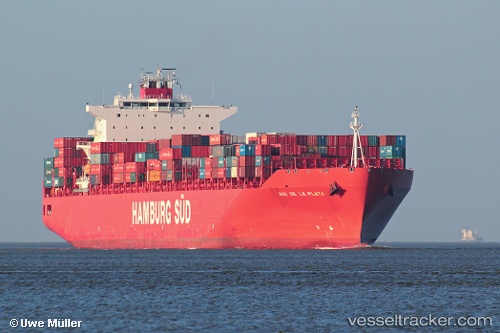
Vessel Rio De La Plata IMO: 9357951, MMSI: 563052200 Container Ship
UTC, -45.81005, 170.62798, course: 202, speed: 0
UTC, -45.81004, 170.62799, course: 202, speed: 0
2026-03-24 12:02:39 UTC, -45.81005, 170.62798, course: 202, speed: 0
Live Vessel Rio De La Plata Analytics (details, animations, etc.)
Live AIS position: UTC. Near Port Chalmers), updated 2026-03-24 12:02:39 UTC.Find the position of the vessel Rio De La Plata on the map. The latter are known coordinates and path.
marine traffic ship tracker show on live map
The current position of vessel Rio De La Plata is -45.81005 lat / 170.62798 lng. Updated: 2026-03-24 12:02:39 UTCDetails:
Last coordinates of the vessel:
UTC, -45.81002, 170.62798, course: 202, speed: 0UTC, -45.81005, 170.62798, course: 202, speed: 0
UTC, -45.81004, 170.62799, course: 202, speed: 0
2026-03-24 12:02:39 UTC, -45.81005, 170.62798, course: 202, speed: 0