 vesseltracker.com
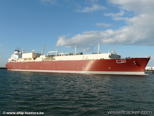
Vessel Al Utouriya IMO: 9360867, MMSI: 538003020 Lng Tanker
UTC, 43.70240, 14.37643, course: 315, speed: 17.1
UTC, 43.97593, 13.83843, course: 306, speed: 17.1
2026-03-24 11:40:49 UTC, 44.27986, 13.29196, course: 308, speed: 15.5
Live Vessel Al Utouriya Analytics (details, animations, etc.)
Live AIS position: UTC. Near ANNAMARIA A), updated 2026-03-24 11:40:49 UTC.Find the position of the vessel Al Utouriya on the map. The latter are known coordinates and path.
marine traffic ship tracker show on live map
The current position of vessel Al Utouriya is 44.27986 lat / 13.29196 lng. Updated: 2026-03-24 11:40:49 UTCCurrently sailing under the flag of Marshall Is
Al Utouriya built in 2007 year
Deadweight:
104561 tDetails:
Last coordinates of the vessel:
UTC, 43.09286, 14.99943, course: 318, speed: 17.1UTC, 43.70240, 14.37643, course: 315, speed: 17.1
UTC, 43.97593, 13.83843, course: 306, speed: 17.1
2026-03-24 11:40:49 UTC, 44.27986, 13.29196, course: 308, speed: 15.5