 vesseltracker.com
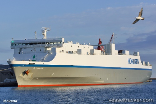
 Houou Maru
Current Status
Where is the vessel?
Houou Maru is currently in 29 nm S of Gobo Wakayama, based on AIS data received about 2h ago.
Latest AIS update:
Current position: 33.40903° N, 135.11185° E (29 nm S of Gobo Wakayama)
Average speed (last 7 days): Loading…
Average speed (last 30 days): Loading…
Vessel profile: Houou Maru is a Vehicles Carrier with dimensions 173m x 173m.
This page combines live AIS, route history, probable destination signals, nearby traffic, and port activity for practical vessel monitoring.
The current position of vessel Houou Maru is 33.40903 lat / 135.11185 lng. Updated: 2026-03-25 22:39:56 UTCNearest reference points:
- 18 nm SE of Gobo Wakayama
- 12 nm S of Gobo Wakayama
- 40 nm SW of Minachi
Currently sailing under the flag of Japan ![]()
Details:
Live Vessel Houou Maru Analytics (details, animations, etc.)
Recent AIS points (UTC):
2026-03-25 17:35:22 UTC · 34.05666, 136.87592 · SOG 21.2 kn · COG 227°2026-03-25 19:57:04 UTC · 33.52435, 136.07498 · SOG 21.7 kn · COG 231°
2026-03-25 22:18:38 UTC · 33.41805, 135.24495 · SOG 18.1 kn · COG 271°
2026-03-25 22:39:56 UTC · 33.40903, 135.11185 · SOG 20.2 kn · COG 252°