 vesseltracker.com
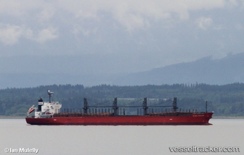
Vessel SOFIA K IMO: 9378838, MMSI: 636019840 Bulk Carrier
UTC, -18.07355, 49.42272, course: -1, speed: 0.3
UTC, -18.07358, 49.42275, course: -1, speed: 0.1
2026-03-20 15:08:16 UTC, -18.07400, 49.42247, course: -1, speed: 0.4
Live Vessel SOFIA K Analytics (details, animations, etc.)
Live AIS position: UTC. Near Tamatave), updated 2026-03-20 15:08:16 UTC.Find the position of the vessel SOFIA K on the map. The latter are known coordinates and path.
marine traffic ship tracker show on live map
The current position of vessel SOFIA K is -18.07400 lat / 49.42247 lng. Updated: 2026-03-20 15:08:16 UTCCurrently sailing under the flag of Liberia
SOFIA K built in 2009 year
Deadweight:
32115 tDetails:
Last coordinates of the vessel:
UTC, -18.07341, 49.42283, course: -1, speed: 0.3UTC, -18.07355, 49.42272, course: -1, speed: 0.3
UTC, -18.07358, 49.42275, course: -1, speed: 0.1
2026-03-20 15:08:16 UTC, -18.07400, 49.42247, course: -1, speed: 0.4