 vesseltracker.com
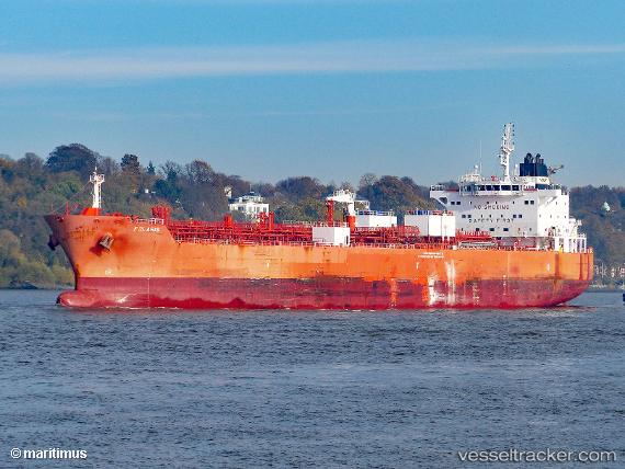
 POLARIS
Current Status
Where is the vessel?
POLARIS is currently in Near Dock Sur, based on AIS data received about 2h ago.
Latest AIS update:
Current position: 34.63563° S, 58.33990° W (Near Dock Sur)
Average speed (last 7 days): Loading…
Average speed (last 30 days): Loading…
Vessel profile: POLARIS is a Chemical/Oil Products Tanker with dimensions 128m x 20m.
This page combines live AIS, route history, probable destination signals, nearby traffic, and port activity for practical vessel monitoring.
The current position of vessel POLARIS is -34.63563 lat / -58.33990 lng. Updated: 2026-03-25 12:02:42 UTCNearest reference points:
- Near Dock Sur
- Near Avellaneda
- Near JUAN LACAZE
Currently sailing under the flag of Argentina ![]()
POLARIS built in 2009 year
Deadweight:
13107 tDetails:
Live Vessel POLARIS Analytics (details, animations, etc.)
Recent AIS points (UTC):
2026-03-25 06:02:59 UTC · -34.63564, -58.33983 · SOG 0 kn · COG -1°2026-03-25 07:36:58 UTC · -34.63566, -58.33989 · SOG 0 kn · COG -1°
2026-03-25 09:50:42 UTC · -34.63565, -58.33987 · SOG 0 kn · COG 4°
2026-03-25 12:02:42 UTC · -34.63563, -58.33990 · SOG 0 kn · COG 4°