 vesseltracker.com
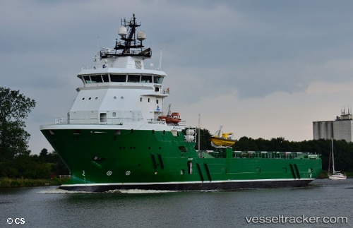
Vessel OCEANICASUB VIII IMO: 9390551, MMSI: 710006368 Offshore Supply Ship
UTC, -11.16741, -37.07929, course: 77, speed: 0.2
UTC, -11.16742, -37.07924, course: 77, speed: 0.2
2026-03-24 19:25:54 UTC, -11.16742, -37.07925, course: 77, speed: 0.1
Live Vessel OCEANICASUB VIII Analytics (details, animations, etc.)
Live AIS position: UTC. 12 nm SW of Aracaju), updated 2026-03-24 19:25:54 UTC.Find the position of the vessel OCEANICASUB VIII on the map. The latter are known coordinates and path.
marine traffic ship tracker show on live map
The current position of vessel OCEANICASUB VIII is -11.16742 lat / -37.07925 lng. Updated: 2026-03-24 19:25:54 UTCDetails:
Last coordinates of the vessel:
UTC, -11.16761, -37.07946, course: 63, speed: 0.3UTC, -11.16741, -37.07929, course: 77, speed: 0.2
UTC, -11.16742, -37.07924, course: 77, speed: 0.2
2026-03-24 19:25:54 UTC, -11.16742, -37.07925, course: 77, speed: 0.1