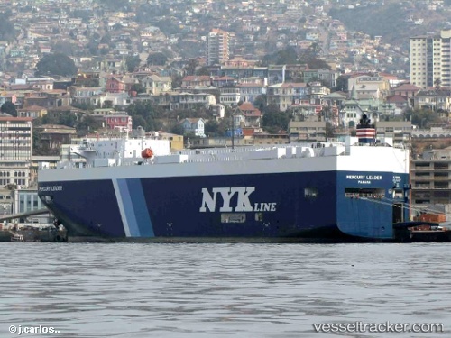
Mercury Leader
Current StatusWhere is the vessel?
Mercury Leader is currently in 65 nm S of Gan, based on AIS data received about 14h ago.
Latest AIS update:
Current position: 1.77527° S, 73.31340° E (65 nm S of Gan)
Average speed (last 7 days): Loading…
Average speed (last 30 days): Loading…
Vessel profile: Mercury Leader is a Vehicles Carrier with dimensions 28m x 186m.
This page combines live AIS, route history, probable destination signals, nearby traffic, and port activity for practical vessel monitoring.
The current position of vessel Mercury Leader is -1.77527 lat / 73.31340 lng. Updated: 2026-05-23 11:36:42 UTCNearest reference points:
- 195 nm SE of Gan
- 222 nm SW of Gan
Details:
Live Vessel Mercury Leader Analytics (details, animations, etc.)
Recent AIS points (UTC):
2026-05-23 07:43:59 UTC · -1.08332, 74.05685 · SOG 15.7 kn · COG 231°2026-05-23 09:57:37 UTC · -1.47927, 73.63076 · SOG 15.5 kn · COG 232°
2026-05-23 09:59:10 UTC · -1.48366, 73.62606 · SOG 15.5 kn · COG -1°
2026-05-23 11:36:42 UTC · -1.77527, 73.31340 · SOG 15.6 kn · COG 233°