 vesseltracker.com
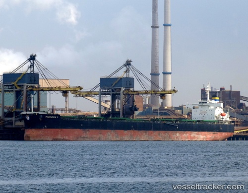
Vessel Manousos P IMO: 9394753, MMSI: 636013647 Bulk Carrier
UTC, -32.65425, -60.73689, course: 325, speed: 0.2
UTC, -32.78632, -60.71039, course: 34, speed: 3.2
2026-02-14 14:22:00 UTC, -32.77194, -60.71511, course: 347, speed: 0
Live AIS position:
UTC. Near Fray Luis A. Beltrán),
updated 2026-02-14 14:22:00 UTC.
Find the position of the vessel Manousos P on the map. The latter are known coordinates and path.
marine traffic ship tracker show on live map
The current position of vessel Manousos P is -32.77194 lat / -60.71511 lng. Updated: 2026-02-14 14:22:00 UTCDetails:
Last coordinates of the vessel:
UTC, -32.65402, -60.73743, course: 323, speed: 0UTC, -32.65425, -60.73689, course: 325, speed: 0.2
UTC, -32.78632, -60.71039, course: 34, speed: 3.2
2026-02-14 14:22:00 UTC, -32.77194, -60.71511, course: 347, speed: 0