 vesseltracker.com
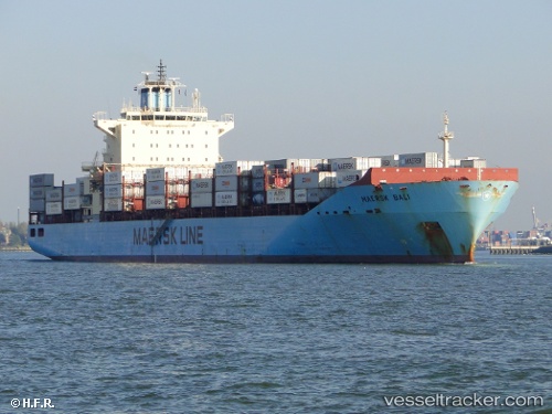
Vessel Maersk Bali IMO: 9394870, MMSI: 563102000 Container Ship
UTC, 51.32613, 4.34002, course: 80, speed: 0
UTC, 51.32612, 4.34004, course: 80, speed: 0
2026-02-17 15:55:35 UTC, 51.32612, 4.34003, course: 80, speed: 0
Live AIS position:
UTC. Near Berendrecht),
updated 2026-02-17 15:55:35 UTC.
Find the position of the vessel Maersk Bali on the map. The latter are known coordinates and path.
marine traffic ship tracker show on live map
The current position of vessel Maersk Bali is 51.32612 lat / 4.34003 lng. Updated: 2026-02-17 15:55:35 UTCCurrently sailing under the flag of Singapore
Maersk Bali built in 2008 year
Deadweight:
43206 tDetails:
Last coordinates of the vessel:
UTC, 51.32616, 4.34007, course: 80, speed: 0UTC, 51.32613, 4.34002, course: 80, speed: 0
UTC, 51.32612, 4.34004, course: 80, speed: 0
2026-02-17 15:55:35 UTC, 51.32612, 4.34003, course: 80, speed: 0