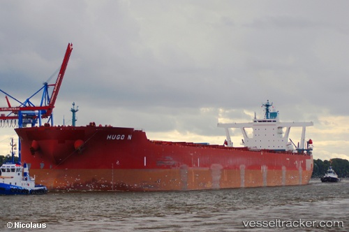
Hugo N
Current StatusWhere is the vessel?
Hugo N is currently in Open sea (no nearby ports in database), based on AIS data received about 109d ago.
Latest AIS update:
Current position: 44.00982° S, 51.55728° E (Open sea (no nearby ports in database))
Average speed (last 7 days): Loading…
Average speed (last 30 days): Loading…
Vessel profile: Hugo N is a Ore Carrier with dimensions 55m x 327m.
This page combines live AIS, route history, probable destination signals, nearby traffic, and port activity for practical vessel monitoring.
The current position of vessel Hugo N is -44.00982 lat / 51.55728 lng. Updated: 2026-02-02 21:49:57 UTCNearest reference points:
- Open sea (no nearby ports in database)
Details:
Live Vessel Hugo N Analytics (details, animations, etc.)
Recent AIS points (UTC):
2026-02-02 21:49:57 UTC · -44.00982, 51.55728 · SOG 68.1 kn · COG 0°