 vesseltracker.com
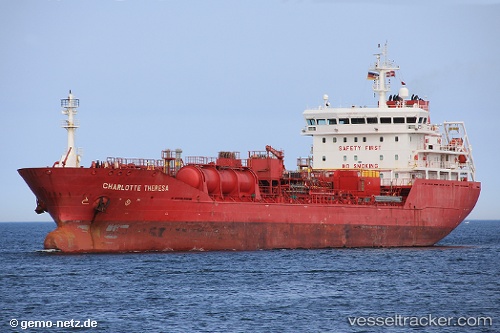
Vessel Charlotte Theresa IMO: 9400708, MMSI: 220625000 Chemical Oil Products Tanker
UTC, 54.13528, 6.28729, course: 82, speed: 11.7
UTC, 54.15057, 6.90262, course: -1, speed: 10.6
2026-03-20 13:42:46 UTC, 54.15803, 7.42261, course: 89, speed: 10.2
Live Vessel Charlotte Theresa Analytics (details, animations, etc.)
Live AIS position: UTC. 12 nm S of Haspe), updated 2026-03-20 13:42:46 UTC.Find the position of the vessel Charlotte Theresa on the map. The latter are known coordinates and path.
marine traffic ship tracker show on live map
The current position of vessel Charlotte Theresa is 54.15803 lat / 7.42261 lng. Updated: 2026-03-20 13:42:46 UTCCurrently sailing under the flag of Denmark
Charlotte Theresa built in 2008 year
Deadweight:
11372 tDetails:
Last coordinates of the vessel:
UTC, 54.08571, 5.68406, course: 81, speed: 12UTC, 54.13528, 6.28729, course: 82, speed: 11.7
UTC, 54.15057, 6.90262, course: -1, speed: 10.6
2026-03-20 13:42:46 UTC, 54.15803, 7.42261, course: 89, speed: 10.2