 vesseltracker.com
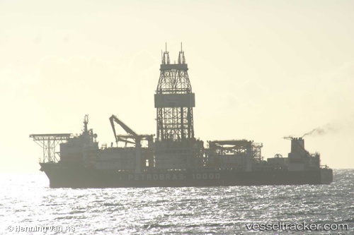
 PETROBRAS 10000
Current Status
Where is the vessel?
PETROBRAS 10000 is currently in 26 nm SW of Fluminense FPSO, based on AIS data received about 1h ago.
Latest AIS update:
Current position: 22.96733° S, 40.72350° W (26 nm SW of Fluminense FPSO)
Average speed (last 7 days): Loading…
Average speed (last 30 days): Loading…
Vessel profile: PETROBRAS 10000 is a Drilling Ship with dimensions 40m x 227m.
This page combines live AIS, route history, probable destination signals, nearby traffic, and port activity for practical vessel monitoring.
The current position of vessel PETROBRAS 10000 is -22.96733 lat / -40.72350 lng. Updated: 2026-03-25 07:15:26 UTCNearest reference points:
- Near Fluminense FPSO
- 47 nm E of Arraial do Cabo
- 24 nm SE of Carapebus
Currently sailing under the flag of Marshall Islands ![]()
PETROBRAS 10000 built in 2009 year
Deadweight:
61403 tDetails:
Live Vessel PETROBRAS 10000 Analytics (details, animations, etc.)
Recent AIS points (UTC):
2026-03-25 01:32:35 UTC · -22.96750, -40.72333 · SOG 0.1 kn · COG 38°2026-03-25 03:49:36 UTC · -22.96733, -40.72350 · SOG 0.1 kn · COG 30°
2026-03-25 06:07:16 UTC · -22.96733, -40.72350 · SOG 0.2 kn · COG 30°
2026-03-25 07:15:26 UTC · -22.96733, -40.72350 · SOG 0.1 kn · COG 30°