 vesseltracker.com
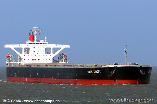
Vessel Cape Unity IMO: 9406489, MMSI: 355458000 Bulk Carrier
UTC, -19.07874, 54.40222, course: 225, speed: 13.1
UTC, -19.32810, 54.13688, course: 223, speed: 13.1
2026-02-25 05:44:52 UTC, -19.63971, 53.80215, course: 227, speed: 13
Live AIS position:
UTC. 113 nm NW of Pointe des Galets),
updated 2026-02-25 05:44:52 UTC.
Find the position of the vessel Cape Unity on the map. The latter are known coordinates and path.
marine traffic ship tracker show on live map
The current position of vessel Cape Unity is -19.63971 lat / 53.80215 lng. Updated: 2026-02-25 05:44:52 UTCDetails:
Last coordinates of the vessel:
UTC, -18.71327, 54.79637, course: 224, speed: 12.9UTC, -19.07874, 54.40222, course: 225, speed: 13.1
UTC, -19.32810, 54.13688, course: 223, speed: 13.1
2026-02-25 05:44:52 UTC, -19.63971, 53.80215, course: 227, speed: 13