 vesseltracker.com
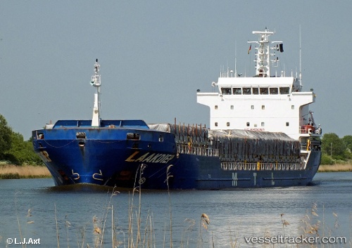
Vessel Kris IMO: 9408889, MMSI: 304502000 General Cargo Ship
UTC, 33.16680, -8.66590, course: 14, speed: 0.7
UTC, 33.16667, -8.66500, course: -1, speed: 1
2026-02-21 16:04:10 UTC, 33.16688, -8.66618, course: 23, speed: 0.4
Live AIS position:
UTC. Near Jorf Lasfar),
updated 2026-02-21 16:04:10 UTC.
ex Gallno
ex MMSI: 255806399
Find the position of the vessel Kris on the map. The latter are known coordinates and path.
marine traffic ship tracker show on live map
The current position of vessel Kris is 33.16688 lat / -8.66618 lng. Updated: 2026-02-21 16:04:10 UTCCurrently sailing under the flag of Antigua Barbuda
Kris built in 2007 year
Deadweight:
7777 tDetails:
ex Gallno
ex MMSI: 255806399
Last coordinates of the vessel:
UTC, 33.16693, -8.66622, course: 33, speed: 0.4UTC, 33.16680, -8.66590, course: 14, speed: 0.7
UTC, 33.16667, -8.66500, course: -1, speed: 1
2026-02-21 16:04:10 UTC, 33.16688, -8.66618, course: 23, speed: 0.4