 vesseltracker.com
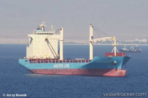
 Maersk Weymouth
Current Status
Where is the vessel?
Maersk Weymouth is currently in 107 nm SE of Gulfmex Lightering Area, based on AIS data received about 2h ago.
Latest AIS update:
Current position: 26.41339° N, 89.49975° W (107 nm SE of Gulfmex Lightering Area)
Average speed (last 7 days): Loading…
Average speed (last 30 days): Loading…
Vessel profile: Maersk Weymouth is a Container Ship with dimensions 175m x 28m.
This page combines live AIS, route history, probable destination signals, nearby traffic, and port activity for practical vessel monitoring.
The current position of vessel Maersk Weymouth is 26.41339 lat / -89.49975 lng. Updated: 2026-03-25 17:45:26 UTCNearest reference points:
- 94 nm S of Gulfmex Lightering Area
- 124 nm SW of Gulfmex Lightering Area
- 66 nm NW of Gulfmex Lightering Area
Currently sailing under the flag of Liberia ![]()
Maersk Weymouth built in 2009 year
Deadweight:
22314 tDetails:
Live Vessel Maersk Weymouth Analytics (details, animations, etc.)
Recent AIS points (UTC):
2026-03-25 11:22:47 UTC · 28.27795, -89.31297 · SOG 17.5 kn · COG 191°2026-03-25 14:17:13 UTC · 27.43833, -89.40333 · SOG 16 kn · COG -1°
2026-03-25 16:02:11 UTC · 26.92667, -89.44167 · SOG 17 kn · COG -1°
2026-03-25 17:45:26 UTC · 26.41339, -89.49975 · SOG 18.1 kn · COG -1°