 vesseltracker.com
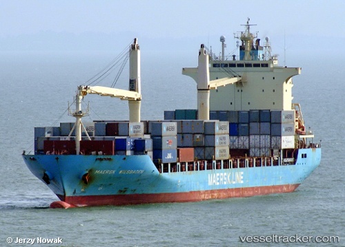
Vessel Maersk Wiesbaden IMO: 9410272, MMSI: 255806152 Container Ship
UTC, 34.63298, 24.92270, course: 152, speed: 6.3
UTC, 34.70062, 24.92440, course: 355, speed: 10.1
2026-02-21 10:06:35 UTC, 34.96167, 24.29667, course: -1, speed: 13
Live AIS position:
UTC. 11 nm NE of Gavdos Chanea),
updated 2026-02-21 10:06:35 UTC.
Find the position of the vessel Maersk Wiesbaden on the map. The latter are known coordinates and path.
marine traffic ship tracker show on live map
The current position of vessel Maersk Wiesbaden is 34.96167 lat / 24.29667 lng. Updated: 2026-02-21 10:06:35 UTCCurrently sailing under the flag of Portugal
Maersk Wiesbaden built in 2010 year
Deadweight:
22314 tDetails:
Last coordinates of the vessel:
UTC, 34.70459, 24.91991, course: 185, speed: 6.1UTC, 34.63298, 24.92270, course: 152, speed: 6.3
UTC, 34.70062, 24.92440, course: 355, speed: 10.1
2026-02-21 10:06:35 UTC, 34.96167, 24.29667, course: -1, speed: 13