 vesseltracker.com
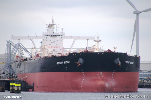
Vessel FRONT SIGNE IMO: 9410997, MMSI: 538009040 Crude Oil Tanker
UTC, 9.06441, 75.13036, course: 317, speed: 13
UTC, 9.50268, 74.86117, course: 331, speed: 13.9
2026-02-24 00:28:56 UTC, 9.93731, 74.60658, course: 331, speed: 14.4
Live AIS position:
UTC. 58 nm E of Kalpeni Island),
updated 2026-02-24 00:28:56 UTC.
Find the position of the vessel FRONT SIGNE on the map. The latter are known coordinates and path.
marine traffic ship tracker show on live map
The current position of vessel FRONT SIGNE is 9.93731 lat / 74.60658 lng. Updated: 2026-02-24 00:28:56 UTCCurrently sailing under the flag of Marshall Islands
FRONT SIGNE built in 2010 year
Deadweight:
297007 tDetails:
Last coordinates of the vessel:
UTC, 8.61546, 75.44744, course: 319, speed: 12.9UTC, 9.06441, 75.13036, course: 317, speed: 13
UTC, 9.50268, 74.86117, course: 331, speed: 13.9
2026-02-24 00:28:56 UTC, 9.93731, 74.60658, course: 331, speed: 14.4