 vesseltracker.com
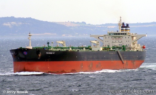
Vessel Yannis P IMO: 9411343, MMSI: 538008332 Crude Oil Tanker
UTC, 13.64017, 71.00157, course: 134, speed: 12
UTC, 13.43035, 71.26055, course: 133, speed: 11.4
2026-02-08 05:00:37 UTC, 13.30797, 71.39840, course: 130, speed: 1.6
Live AIS position:
UTC. 153 nm NW of Amini Island),
updated 2026-02-08 05:00:37 UTC.
Find the position of the vessel Yannis P on the map. The latter are known coordinates and path.
marine traffic ship tracker show on live map
The current position of vessel Yannis P is 13.30797 lat / 71.39840 lng. Updated: 2026-02-08 05:00:37 UTCCurrently sailing under the flag of Marshall Is
Yannis P built in 2010 year
Deadweight:
158149 tDetails:
Last coordinates of the vessel:
UTC, 13.91993, 70.72935, course: 135, speed: 12.1UTC, 13.64017, 71.00157, course: 134, speed: 12
UTC, 13.43035, 71.26055, course: 133, speed: 11.4
2026-02-08 05:00:37 UTC, 13.30797, 71.39840, course: 130, speed: 1.6