 vesseltracker.com
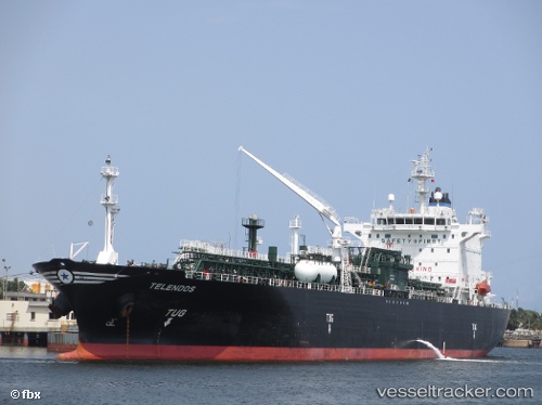
Vessel TELENDOS IMO: 9412086, MMSI: 636020889 LPG Tanker
UTC, 25.26767, 56.51087, course: 241, speed: 0
UTC, 25.26642, 56.51117, course: 299, speed: 0
2026-02-18 10:23:59 UTC, 25.26545, 56.50948, course: 23, speed: 0
Live AIS position:
UTC. Near Fujairah),
updated 2026-02-18 10:23:59 UTC.
Find the position of the vessel TELENDOS on the map. The latter are known coordinates and path.
marine traffic ship tracker show on live map
The current position of vessel TELENDOS is 25.26545 lat / 56.50948 lng. Updated: 2026-02-18 10:23:59 UTCCurrently sailing under the flag of Liberia
TELENDOS built in 2010 year
Deadweight:
26634 tDetails:
Last coordinates of the vessel:
UTC, 25.26696, 56.51127, course: 269, speed: 0UTC, 25.26767, 56.51087, course: 241, speed: 0
UTC, 25.26642, 56.51117, course: 299, speed: 0
2026-02-18 10:23:59 UTC, 25.26545, 56.50948, course: 23, speed: 0