 vesseltracker.com
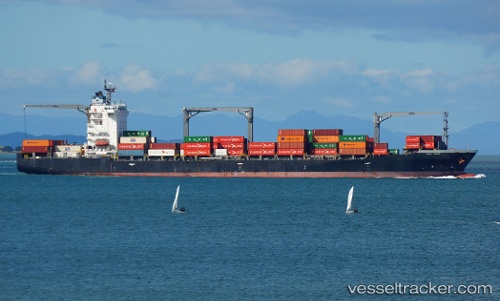
Vessel MSC RINI III IMO: 9419644, MMSI: 636021011 Container Ship
UTC, -19.02202, 174.63922, course: 66, speed: 15
UTC, -18.88097, 174.96915, course: 67, speed: 14.6
2026-03-21 18:10:42 UTC, -18.60723, 175.61188, course: 65, speed: 10.6
Live Vessel MSC RINI III Analytics (details, animations, etc.)
Live AIS position: UTC. 103 nm SW of MAOLO LAILAI), updated 2026-03-21 18:10:42 UTC.Find the position of the vessel MSC RINI III on the map. The latter are known coordinates and path.
marine traffic ship tracker show on live map
The current position of vessel MSC RINI III is -18.60723 lat / 175.61188 lng. Updated: 2026-03-21 18:10:42 UTCCurrently sailing under the flag of Liberia
MSC RINI III built in 2009 year
Deadweight:
34528 tDetails:
Last coordinates of the vessel:
UTC, -19.24921, 174.10638, course: 65, speed: 15.1UTC, -19.02202, 174.63922, course: 66, speed: 15
UTC, -18.88097, 174.96915, course: 67, speed: 14.6
2026-03-21 18:10:42 UTC, -18.60723, 175.61188, course: 65, speed: 10.6