 vesseltracker.com
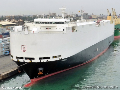
 PAGNA
PAGNA
Current Status
Where is the vessel?
PAGNA is currently in 314 nm N of Johnston Island, based on AIS data received about 2h ago.
Latest AIS update:
Current position: 21.93377° N, 169.04604° W (314 nm N of Johnston Island)
Average speed (last 7 days): Loading…
Average speed (last 30 days): Loading…
Vessel profile: PAGNA is a Vehicles Carrier with dimensions m x m.
This page combines live AIS, route history, probable destination signals, nearby traffic, and port activity for practical vessel monitoring.
The current position of vessel PAGNA is 21.93377 lat / -169.04604 lng. Updated: 2026-03-25 13:54:51 UTCNearest reference points:
- Open sea (no nearby ports in database)
- Open sea, approx. 444 nm off the nearest listed port
- Open sea, approx. 439 nm off the nearest listed port
Currently sailing under the flag of Marshall Islands ![]()
Details:
Live Vessel PAGNA Analytics (details, animations, etc.)
Recent AIS points (UTC):
2026-03-25 07:52:30 UTC · 21.66756, -167.23904 · SOG 17 kn · COG 278°2026-03-25 10:03:02 UTC · 21.76225, -167.88580 · SOG 16.5 kn · COG 280°
2026-03-25 11:47:58 UTC · 21.83988, -168.41074 · SOG 17.1 kn · COG 281°
2026-03-25 13:54:51 UTC · 21.93377, -169.04604 · SOG 16.7 kn · COG 281°