 vesseltracker.com
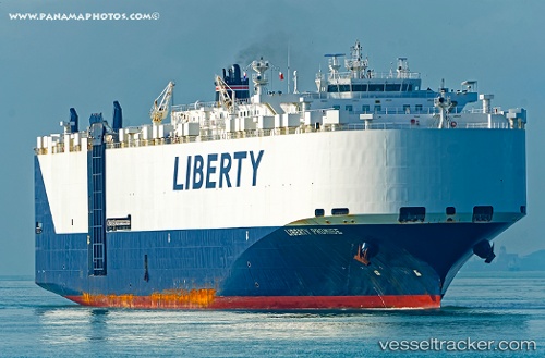
Vessel Liberty Promise IMO: 9448425, MMSI: 366102000 Vehicles Carrier
UTC, 48.97343, -134.39716, course: 269, speed: 13.5
UTC, 48.99770, -135.22125, course: 269, speed: 12.4
2026-02-25 16:02:49 UTC, 49.01425, -135.80881, course: 272, speed: 13.2
Live AIS position:
UTC. 223 nm N of Primorsky Krai),
updated 2026-02-25 16:02:49 UTC.
Find the position of the vessel Liberty Promise on the map. The latter are known coordinates and path.
marine traffic ship tracker show on live map
The current position of vessel Liberty Promise is 49.01425 lat / -135.80881 lng. Updated: 2026-02-25 16:02:49 UTCCurrently sailing under the flag of USA
Liberty Promise built in 2010 year
Deadweight:
21359 tDetails:
Last coordinates of the vessel:
UTC, 48.98175, -133.78627, course: 268, speed: 14UTC, 48.97343, -134.39716, course: 269, speed: 13.5
UTC, 48.99770, -135.22125, course: 269, speed: 12.4
2026-02-25 16:02:49 UTC, 49.01425, -135.80881, course: 272, speed: 13.2