 vesseltracker.com
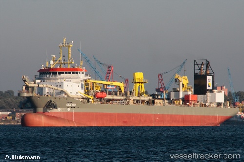
Vessel Gateway IMO: 9448994, MMSI: 210050000 Hopper Dredger
UTC, 51.89072, 4.45209, course: 285, speed: 0
UTC, 51.89074, 4.45204, course: 285, speed: 0
2026-02-25 07:40:39 UTC, 51.89072, 4.45209, course: 285, speed: 0
Live AIS position:
UTC. Near Rotterdam),
updated 2026-02-25 07:40:39 UTC.
Find the position of the vessel Gateway on the map. The latter are known coordinates and path.
marine traffic ship tracker show on live map
The current position of vessel Gateway is 51.89072 lat / 4.45209 lng. Updated: 2026-02-25 07:40:39 UTCCurrently sailing under the flag of Cyprus
Gateway built in 2010 year
Deadweight:
21200 tDetails:
Last coordinates of the vessel:
UTC, 51.89074, 4.45211, course: 285, speed: 0UTC, 51.89072, 4.45209, course: 285, speed: 0
UTC, 51.89074, 4.45204, course: 285, speed: 0
2026-02-25 07:40:39 UTC, 51.89072, 4.45209, course: 285, speed: 0