 vesseltracker.com
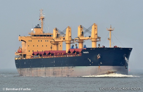
Vessel XIN HAI TONG 66 IMO: 9449247, MMSI: 538011974 Bulk Carrier
UTC, 21.46682, 39.16253, course: -1, speed: 0
UTC, 21.46682, 39.16258, course: 106, speed: 0
2026-03-25 01:21:46 UTC, 21.46685, 39.16265, course: 106, speed: 0
Live Vessel XIN HAI TONG 66 Analytics (details, animations, etc.)
Live AIS position: UTC. Near Jiddah), updated 2026-03-25 01:21:46 UTC.Find the position of the vessel XIN HAI TONG 66 on the map. The latter are known coordinates and path.
marine traffic ship tracker show on live map
The current position of vessel XIN HAI TONG 66 is 21.46685 lat / 39.16265 lng. Updated: 2026-03-25 01:21:46 UTCCurrently sailing under the flag of Marshall Islands
Details:
Last coordinates of the vessel:
UTC, 21.46685, 39.16259, course: 105, speed: 0UTC, 21.46682, 39.16253, course: -1, speed: 0
UTC, 21.46682, 39.16258, course: 106, speed: 0
2026-03-25 01:21:46 UTC, 21.46685, 39.16265, course: 106, speed: 0