 vesseltracker.com
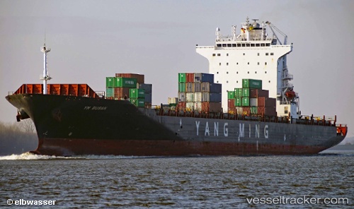
Vessel 'SYNERGY BUSAN' IMO: 9450571, MMSI: 538008755
UTC, 38.95567, 118.09278, course: 275, speed: 0
UTC, 38.95734, 118.08832, course: 131, speed: 0.1
2026-02-09 08:11:34 UTC, 38.95772, 118.08883, course: 147, speed: 0
Live AIS position:
UTC. Near Taku Bar),
updated 2026-02-09 08:11:34 UTC.
Find the position of the vessel 'SYNERGY BUSAN' on the map. The latter are known coordinates and path.
marine traffic ship tracker show on live map
The current position of vessel 'SYNERGY BUSAN' is 38.95772 lat / 118.08883 lng. Updated: 2026-02-09 08:11:34 UTCDetails:
Last coordinates of the vessel:
UTC, 38.95617, 118.09278, course: 265, speed: 0UTC, 38.95567, 118.09278, course: 275, speed: 0
UTC, 38.95734, 118.08832, course: 131, speed: 0.1
2026-02-09 08:11:34 UTC, 38.95772, 118.08883, course: 147, speed: 0