 vesseltracker.com
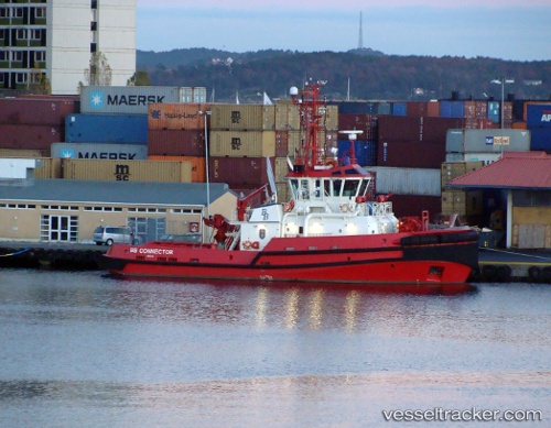
Vessel Bb Connector IMO: 9451549, MMSI: 258242500 Tug
UTC, 68.43281, 17.41276, course: 340, speed: 0
UTC, 68.43285, 17.41268, course: 339, speed: 0
2026-02-26 07:35:43 UTC, 68.43284, 17.41278, course: 338, speed: 0
Live AIS position:
UTC. Near Narvik),
updated 2026-02-26 07:35:43 UTC.
Find the position of the vessel Bb Connector on the map. The latter are known coordinates and path.
marine traffic ship tracker show on live map
The current position of vessel Bb Connector is 68.43284 lat / 17.41278 lng. Updated: 2026-02-26 07:35:43 UTCCurrently sailing under the flag of Norway
Bb Connector built in 2008 year
Deadweight:
242 tDetails:
Last coordinates of the vessel:
UTC, 68.43284, 17.41279, course: 341, speed: 0UTC, 68.43281, 17.41276, course: 340, speed: 0
UTC, 68.43285, 17.41268, course: 339, speed: 0
2026-02-26 07:35:43 UTC, 68.43284, 17.41278, course: 338, speed: 0