 vesseltracker.com
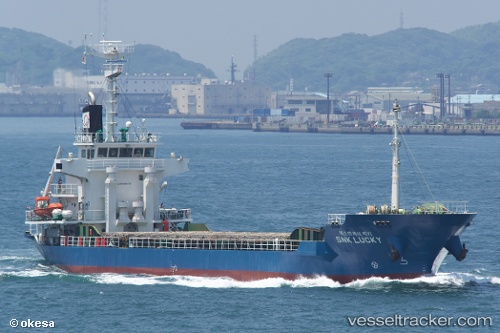
Vessel DAEHO JEJU IMO: 9466178, MMSI: 440116190 General Cargo Ship
UTC, 34.33650, 127.45011, course: 76, speed: 8.8
UTC, 34.38386, 127.83144, course: 81, speed: 9.5
2026-03-24 21:53:52 UTC, 34.50333, 128.27167, course: -1, speed: 10
Live Vessel DAEHO JEJU Analytics (details, animations, etc.)
Live AIS position: UTC. Near Kukdo), updated 2026-03-24 21:53:52 UTC.Find the position of the vessel DAEHO JEJU on the map. The latter are known coordinates and path.
marine traffic ship tracker show on live map
The current position of vessel DAEHO JEJU is 34.50333 lat / 128.27167 lng. Updated: 2026-03-24 21:53:52 UTCCurrently sailing under the flag of Korea (Republic of)
DAEHO JEJU built in 2008 year
Deadweight:
3609 tDetails:
Last coordinates of the vessel:
UTC, 34.28333, 127.11500, course: -1, speed: 8UTC, 34.33650, 127.45011, course: 76, speed: 8.8
UTC, 34.38386, 127.83144, course: 81, speed: 9.5
2026-03-24 21:53:52 UTC, 34.50333, 128.27167, course: -1, speed: 10