 vesseltracker.com
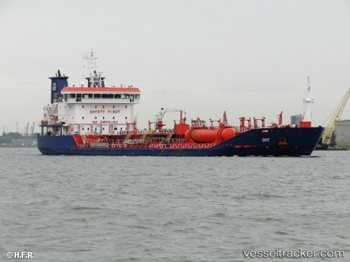
Vessel OVIT IMO: 9466611, MMSI: 256661000 Oil/Chemical Tanker
UTC, 56.11055, -2.55353, course: 92, speed: 10.6
UTC, 55.99310, -1.90115, course: 105, speed: 9.6
2026-03-24 23:55:42 UTC, 55.74948, -1.48374, course: 136, speed: 9.2
Live Vessel OVIT Analytics (details, animations, etc.)
Live AIS position: UTC. 11 nm NE of SEAHOUSES), updated 2026-03-24 23:55:42 UTC.Find the position of the vessel OVIT on the map. The latter are known coordinates and path.
marine traffic ship tracker show on live map
The current position of vessel OVIT is 55.74948 lat / -1.48374 lng. Updated: 2026-03-24 23:55:42 UTCCurrently sailing under the flag of Malta
Details:
Last coordinates of the vessel:
UTC, 56.05135, -3.00167, course: 67, speed: 9.8UTC, 56.11055, -2.55353, course: 92, speed: 10.6
UTC, 55.99310, -1.90115, course: 105, speed: 9.6
2026-03-24 23:55:42 UTC, 55.74948, -1.48374, course: 136, speed: 9.2