 vesseltracker.com
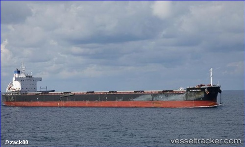
Vessel VITAOCEAN IMO: 9470492, MMSI: 636020212 Bulk Carrier
UTC, -7.06333, 67.98333, course: -1, speed: 11
UTC, -6.72333, 68.34333, course: -1, speed: 11
2026-02-25 17:46:33 UTC, -6.54167, 68.52167, course: -1, speed: 11
Live AIS position:
UTC. 240 nm W of Diego Garcia),
updated 2026-02-25 17:46:33 UTC.
Find the position of the vessel VITAOCEAN on the map. The latter are known coordinates and path.
marine traffic ship tracker show on live map
The current position of vessel VITAOCEAN is -6.54167 lat / 68.52167 lng. Updated: 2026-02-25 17:46:33 UTCCurrently sailing under the flag of Liberia
VITAOCEAN built in 2013 year
Deadweight:
82250 tDetails:
Last coordinates of the vessel:
UTC, -7.33167, 67.72667, course: -1, speed: 10UTC, -7.06333, 67.98333, course: -1, speed: 11
UTC, -6.72333, 68.34333, course: -1, speed: 11
2026-02-25 17:46:33 UTC, -6.54167, 68.52167, course: -1, speed: 11