 vesseltracker.com
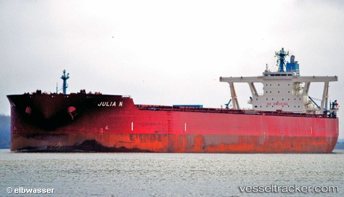
Julia N
Current StatusWhere is the vessel?
Julia N is currently in Near Opol, based on AIS data received about 2h ago.
Latest AIS update:
Current position: 8.68170° N, 124.55177° E (Near Opol)
Average speed (last 7 days): Loading…
Average speed (last 30 days): Loading…
Vessel profile: Julia N is a Ore Carrier with dimensions 55m x 327m.
This page combines live AIS, route history, probable destination signals, nearby traffic, and port activity for practical vessel monitoring.
The current position of vessel Julia N is 8.68170 lat / 124.55177 lng. Updated: 2026-05-15 16:26:07 UTCNearest reference points:
- 17 nm SW of Bacong
- Near Taganito
- Near Hilongos
Details:
Live Vessel Julia N Analytics (details, animations, etc.)
Recent AIS points (UTC):
2026-05-15 13:35:15 UTC · 8.68358, 124.55677 · SOG 0.2 kn · COG 226°2026-05-15 13:35:15 UTC · 8.68358, 124.55677 · SOG 0.2 kn · COG 226°
2026-05-15 16:26:07 UTC · 8.68170, 124.55177 · SOG 0.1 kn · COG 239°
2026-05-15 16:26:07 UTC · 8.68170, 124.55177 · SOG 0.1 kn · COG 239°