 vesseltracker.com
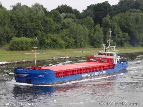
Vessel Anita IMO: 9479577, MMSI: 244615976 Multi Purpose Carrier
UTC, 52.96943, -0.01970, course: 202, speed: 0
UTC, 52.96943, -0.01962, course: 202, speed: 0
2026-01-19 06:41:40 UTC, 52.96941, -0.01975, course: 202, speed: 0
Live AIS position:
UTC. Near Butterwick),
updated 2026-01-19 06:41:40 UTC.
Find the position of the vessel Anita on the map. The latter are known coordinates and path.
marine traffic ship tracker show on live map
The current position of vessel Anita is 52.96941 lat / -0.01975 lng. Updated: 2026-01-19 06:41:40 UTCCurrently sailing under the flag of Netherlands
Anita built in 2013 year
Deadweight:
2625 tDetails:
Last coordinates of the vessel:
UTC, 52.96943, -0.01968, course: 202, speed: 0UTC, 52.96943, -0.01970, course: 202, speed: 0
UTC, 52.96943, -0.01962, course: 202, speed: 0
2026-01-19 06:41:40 UTC, 52.96941, -0.01975, course: 202, speed: 0