 vesseltracker.com
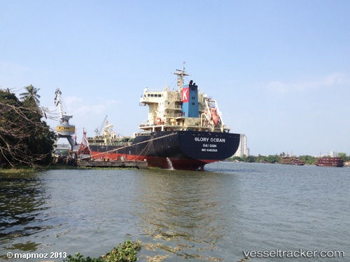
Vessel Glory Ocean IMO: 9480502, MMSI: 574927000 Chemical Oil Products Tanker
UTC, 3.05667, 111.55333, course: -1, speed: 12
UTC, 2.77667, 111.05167, course: -1, speed: 13
2026-02-10 23:37:22 UTC, 2.51167, 111.01667, course: -1, speed: 7
Live AIS position:
UTC. 19 nm W of Pulau Bruit),
updated 2026-02-10 23:37:22 UTC.
Find the position of the vessel Glory Ocean on the map. The latter are known coordinates and path.
marine traffic ship tracker show on live map
The current position of vessel Glory Ocean is 2.51167 lat / 111.01667 lng. Updated: 2026-02-10 23:37:22 UTCDetails:
Last coordinates of the vessel:
UTC, 3.08666, 111.68667, course: -1, speed: 12UTC, 3.05667, 111.55333, course: -1, speed: 12
UTC, 2.77667, 111.05167, course: -1, speed: 13
2026-02-10 23:37:22 UTC, 2.51167, 111.01667, course: -1, speed: 7