 vesseltracker.com
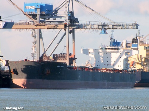
Vessel STAR EVA IMO: 9481702, MMSI: 636020461 Bulk Carrier
UTC, -34.94709, 22.85231, course: 79, speed: 10.3
UTC, -34.89708, 23.12891, course: 84, speed: 9.1
2026-03-05 11:48:03 UTC, -34.80787, 23.60636, course: 84, speed: 11.2
Live Vessel STAR EVA Analytics (details, animations, etc.)
Live AIS position: UTC. 54 nm SE of Knysna), updated 2026-03-05 11:48:03 UTC.Find the position of the vessel STAR EVA on the map. The latter are known coordinates and path.
marine traffic ship tracker show on live map
The current position of vessel STAR EVA is -34.80787 lat / 23.60636 lng. Updated: 2026-03-05 11:48:03 UTCCurrently sailing under the flag of Liberia
STAR EVA built in 2012 year
Deadweight:
106659 tDetails:
Last coordinates of the vessel:
UTC, -35.02155, 22.49823, course: 77, speed: 10.1UTC, -34.94709, 22.85231, course: 79, speed: 10.3
UTC, -34.89708, 23.12891, course: 84, speed: 9.1
2026-03-05 11:48:03 UTC, -34.80787, 23.60636, course: 84, speed: 11.2