 vesseltracker.com
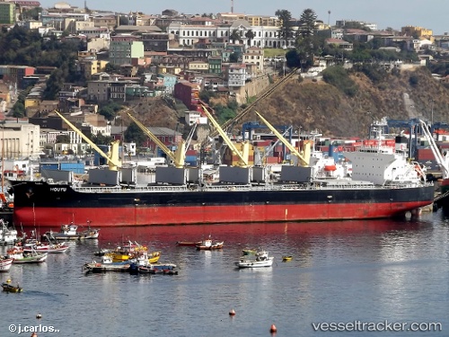
 GEOSAND
Current Status
Where is the vessel?
GEOSAND is currently in Near Paradip, based on AIS data received about 3h ago.
Latest AIS update:
Current position: 20.19040° N, 86.70518° E (Near Paradip)
Average speed (last 7 days): Loading…
Average speed (last 30 days): Loading…
Vessel profile: GEOSAND is a Bulk Carrier with dimensions 190m x 32m.
This page combines live AIS, route history, probable destination signals, nearby traffic, and port activity for practical vessel monitoring.
The current position of vessel GEOSAND is 20.19040 lat / 86.70518 lng. Updated: 2026-03-25 17:33:10 UTCNearest reference points:
- Near Paradip
- Near Paradip Garh
- 45 nm S of Contai
Currently sailing under the flag of Liberia ![]()
GEOSAND built in 2010 year
Deadweight:
55471 tDetails:
Live Vessel GEOSAND Analytics (details, animations, etc.)
Recent AIS points (UTC):
2026-03-25 12:24:08 UTC · 20.18998, 86.70561 · SOG 0.3 kn · COG 231°2026-03-25 14:09:09 UTC · 20.19016, 86.70527 · SOG 0.2 kn · COG 219°
2026-03-25 16:21:06 UTC · 20.19041, 86.70518 · SOG 0.3 kn · COG 213°
2026-03-25 17:33:10 UTC · 20.19040, 86.70518 · SOG 0.1 kn · COG 210°