 vesseltracker.com
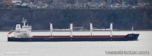
Vessel Amanda C IMO: 9482782, MMSI: 538003693 Bulk Carrier
UTC, 33.12545, -8.63231, course: 123, speed: 0
UTC, 33.12545, -8.63228, course: 123, speed: 0
2026-02-14 15:25:45 UTC, 33.12500, -8.63167, course: -1, speed: 0
Live AIS position:
UTC. Near Jorf Lasfar),
updated 2026-02-14 15:25:45 UTC.
Find the position of the vessel Amanda C on the map. The latter are known coordinates and path.
marine traffic ship tracker show on live map
The current position of vessel Amanda C is 33.12500 lat / -8.63167 lng. Updated: 2026-02-14 15:25:45 UTCCurrently sailing under the flag of Marshall Is
Amanda C built in 2012 year
Deadweight:
34449 tDetails:
Last coordinates of the vessel:
UTC, 33.12539, -8.63228, course: 123, speed: 0UTC, 33.12545, -8.63231, course: 123, speed: 0
UTC, 33.12545, -8.63228, course: 123, speed: 0
2026-02-14 15:25:45 UTC, 33.12500, -8.63167, course: -1, speed: 0