 vesseltracker.com
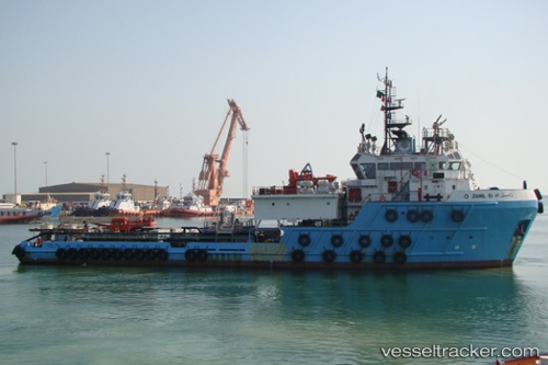
Vessel ZAMIL 51 IMO: 9487512, MMSI: 403611000 Offshore Tug/Supply Ship
UTC, 26.66742, 50.18352, course: 12, speed: 0.4
UTC, 26.63487, 50.17831, course: 5, speed: 0.1
2026-02-21 13:45:58 UTC, 26.63447, 50.17821, course: 5, speed: 0.1
Live AIS position:
UTC. Near Ras Tannurah),
updated 2026-02-21 13:45:58 UTC.
Find the position of the vessel ZAMIL 51 on the map. The latter are known coordinates and path.
marine traffic ship tracker show on live map
The current position of vessel ZAMIL 51 is 26.63447 lat / 50.17821 lng. Updated: 2026-02-21 13:45:58 UTCCurrently sailing under the flag of Saudi Arabia
ZAMIL 51 built in 2008 year
Deadweight:
1239 tDetails:
Last coordinates of the vessel:
UTC, 26.66891, 50.18430, course: 1, speed: 0UTC, 26.66742, 50.18352, course: 12, speed: 0.4
UTC, 26.63487, 50.17831, course: 5, speed: 0.1
2026-02-21 13:45:58 UTC, 26.63447, 50.17821, course: 5, speed: 0.1