 vesseltracker.com
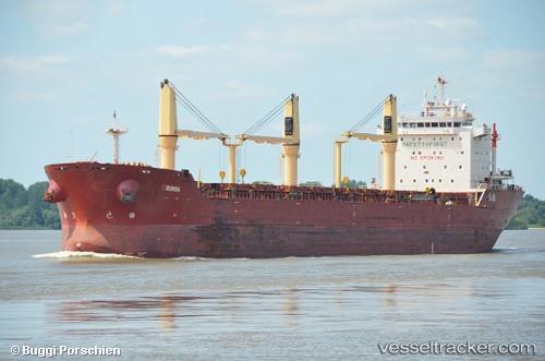
Vessel Sunda IMO: 9498236, MMSI: 636017261 Bulk Carrier
UTC, 43.19072, 27.90037, course: 270, speed: 0
UTC, 43.19076, 27.90041, course: -1, speed: 0
2026-02-25 12:18:29 UTC, 43.19073, 27.90040, course: 270, speed: 0
Live AIS position:
UTC. Near Varna),
updated 2026-02-25 12:18:29 UTC.
Find the position of the vessel Sunda on the map. The latter are known coordinates and path.
marine traffic ship tracker show on live map
The current position of vessel Sunda is 43.19073 lat / 27.90040 lng. Updated: 2026-02-25 12:18:29 UTCCurrently sailing under the flag of Liberia
Sunda built in 2010 year
Deadweight:
29800 tDetails:
Last coordinates of the vessel:
UTC, 43.19067, 27.90038, course: 270, speed: 0UTC, 43.19072, 27.90037, course: 270, speed: 0
UTC, 43.19076, 27.90041, course: -1, speed: 0
2026-02-25 12:18:29 UTC, 43.19073, 27.90040, course: 270, speed: 0