 vesseltracker.com
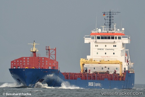
 Louis
Louis
Current Status
Where is the vessel?
Louis is currently in Near Copenhagen, based on AIS data received about 2h ago.
Latest AIS update:
Current position: 55.68651° N, 12.63278° E (Near Copenhagen)
Average speed (last 7 days): Loading…
Average speed (last 30 days): Loading…
Vessel profile: Louis is a Multi Purpose Carrier with dimensions 129m x 17m.
This page combines live AIS, route history, probable destination signals, nearby traffic, and port activity for practical vessel monitoring.
The current position of vessel Louis is 55.68651 lat / 12.63278 lng. Updated: 2026-03-25 11:40:29 UTCNearest reference points:
- Near Skanör
- Near Rungsted
- Near Land Skrona
Currently sailing under the flag of Antigua Barbuda ![]()
Louis built in 2013 year
Deadweight:
8250 tDetails:
Live Vessel Louis Analytics (details, animations, etc.)
Recent AIS points (UTC):
2026-03-25 06:16:30 UTC · 55.68652, 12.63277 · SOG 0 kn · COG 239°2026-03-25 07:43:30 UTC · 55.68650, 12.63278 · SOG 0 kn · COG 239°
2026-03-25 09:25:31 UTC · 55.68653, 12.63278 · SOG 0 kn · COG 240°
2026-03-25 11:40:29 UTC · 55.68651, 12.63278 · SOG 0 kn · COG 239°