 vesseltracker.com
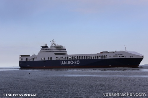
Vessel Un Istanbul IMO: 9506277, MMSI: 271043303 Ro Ro Cargo Ship
UTC, 37.26606, 24.13838, course: 34, speed: 17.6
UTC, 37.62922, 24.48421, course: 24, speed: 10.5
2026-03-24 11:46:34 UTC, 37.96796, 24.65952, course: 23, speed: 10.3
Live Vessel Un Istanbul Analytics (details, animations, etc.)
Live AIS position: UTC. Near Gávrion), updated 2026-03-24 11:46:34 UTC.Find the position of the vessel Un Istanbul on the map. The latter are known coordinates and path.
marine traffic ship tracker show on live map
The current position of vessel Un Istanbul is 37.96796 lat / 24.65952 lng. Updated: 2026-03-24 11:46:34 UTCCurrently sailing under the flag of Turkey
Un Istanbul built in 2013 year
Deadweight:
15000 tDetails:
Last coordinates of the vessel:
UTC, 36.77014, 23.65963, course: 38, speed: 18.4UTC, 37.26606, 24.13838, course: 34, speed: 17.6
UTC, 37.62922, 24.48421, course: 24, speed: 10.5
2026-03-24 11:46:34 UTC, 37.96796, 24.65952, course: 23, speed: 10.3