 vesseltracker.com
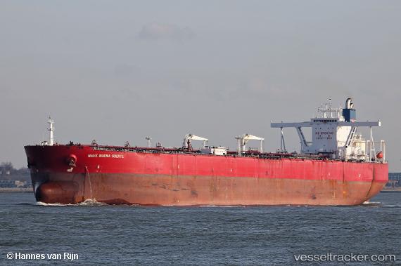
Vessel NAVE BUENA SUERTE IMO: 9514561, MMSI: 636024679 Tanker
UTC, -7.60844, 79.26817, course: 52, speed: 12.6
UTC, -7.27667, 79.65333, course: -1, speed: 12
2026-03-24 10:06:16 UTC, -7.01167, 79.97167, course: -1, speed: 12
Live Vessel NAVE BUENA SUERTE Analytics (details, animations, etc.)
Live AIS position: UTC. Open sea (no nearby ports in database)), updated 2026-03-24 10:06:16 UTC.Find the position of the vessel NAVE BUENA SUERTE on the map. The latter are known coordinates and path.
marine traffic ship tracker show on live map
The current position of vessel NAVE BUENA SUERTE is -7.01167 lat / 79.97167 lng. Updated: 2026-03-24 10:06:16 UTCCurrently sailing under the flag of Liberia
Details:
Last coordinates of the vessel:
UTC, -7.81333, 79.01833, course: -1, speed: 12UTC, -7.60844, 79.26817, course: 52, speed: 12.6
UTC, -7.27667, 79.65333, course: -1, speed: 12
2026-03-24 10:06:16 UTC, -7.01167, 79.97167, course: -1, speed: 12