 vesseltracker.com
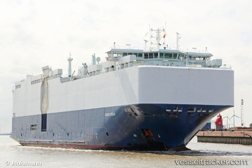
Vessel VIKING OCEAN IMO: 9514999, MMSI: 538009731 Vehicles Carrier
UTC, 44.17720, -124.69387, course: 2, speed: 9.3
UTC, 44.40676, -124.65843, course: 3, speed: 9.1
2026-03-24 15:56:23 UTC, 44.71158, -124.59266, course: 3, speed: 8.8
Live Vessel VIKING OCEAN Analytics (details, animations, etc.)
Live AIS position: UTC. 25 nm W of South Beach), updated 2026-03-24 15:56:23 UTC.Find the position of the vessel VIKING OCEAN on the map. The latter are known coordinates and path.
marine traffic ship tracker show on live map
The current position of vessel VIKING OCEAN is 44.71158 lat / -124.59266 lng. Updated: 2026-03-24 15:56:23 UTCCurrently sailing under the flag of Marshall Islands
VIKING OCEAN built in 2012 year
Deadweight:
12550 tDetails:
Last coordinates of the vessel:
UTC, 43.88118, -124.75831, course: 5, speed: 9.3UTC, 44.17720, -124.69387, course: 2, speed: 9.3
UTC, 44.40676, -124.65843, course: 3, speed: 9.1
2026-03-24 15:56:23 UTC, 44.71158, -124.59266, course: 3, speed: 8.8