 vesseltracker.com
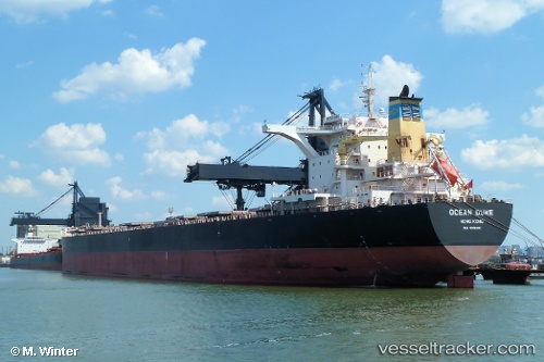
Vessel Ocean Duke IMO: 9518660, MMSI: 477641200 Bulk Carrier
UTC, 15.78500, 119.49667, course: -1, speed: 9
UTC, 16.04333, 119.46833, course: -1, speed: 9
2026-03-24 18:05:55 UTC, 16.36833, 119.45167, course: -1, speed: 9
Live Vessel Ocean Duke Analytics (details, animations, etc.)
Live AIS position: UTC. 25 nm W of Bolinao), updated 2026-03-24 18:05:55 UTC.Find the position of the vessel Ocean Duke on the map. The latter are known coordinates and path.
marine traffic ship tracker show on live map
The current position of vessel Ocean Duke is 16.36833 lat / 119.45167 lng. Updated: 2026-03-24 18:05:55 UTCCurrently sailing under the flag of Hong Kong
Details:
Last coordinates of the vessel:
UTC, 15.47333, 119.55833, course: -1, speed: 9UTC, 15.78500, 119.49667, course: -1, speed: 9
UTC, 16.04333, 119.46833, course: -1, speed: 9
2026-03-24 18:05:55 UTC, 16.36833, 119.45167, course: -1, speed: 9