 vesseltracker.com
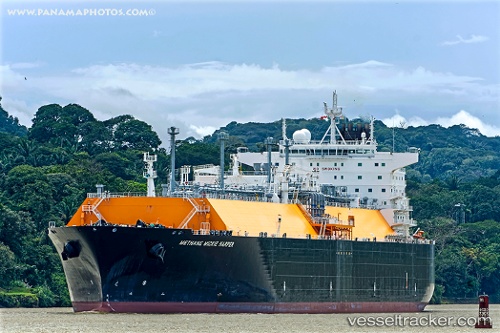
 METHANE MICKIE HARPER
Current Status
Where is the vessel?
METHANE MICKIE HARPER is currently in 83 nm NW of Woleai Atoll, based on AIS data received about 2h ago.
Latest AIS update:
Current position: 8.31167° N, 142.85834° E (83 nm NW of Woleai Atoll)
Average speed (last 7 days): Loading…
Average speed (last 30 days): Loading…
Vessel profile: METHANE MICKIE HARPER is a LNG Tanker with dimensions 45m x 290m.
This page combines live AIS, route history, probable destination signals, nearby traffic, and port activity for practical vessel monitoring.
The current position of vessel METHANE MICKIE HARPER is 8.31167 lat / 142.85834 lng. Updated: 2026-03-25 15:37:18 UTCCurrently sailing under the flag of Panama ![]()
METHANE MICKIE HARPER built in 2010 year
Deadweight:
86170 tDetails:
Live Vessel METHANE MICKIE HARPER Analytics (details, animations, etc.)
Recent AIS points (UTC):
2026-03-25 09:44:39 UTC · 9.80314, 142.13638 · SOG 16.7 kn · COG 152°2026-03-25 12:06:07 UTC · 9.19579, 142.43195 · SOG 16.8 kn · COG 153°
2026-03-25 14:23:42 UTC · 8.61733, 142.70856 · SOG 16.9 kn · COG 151°
2026-03-25 15:37:18 UTC · 8.31167, 142.85834 · SOG 16 kn · COG -1°