 vesseltracker.com
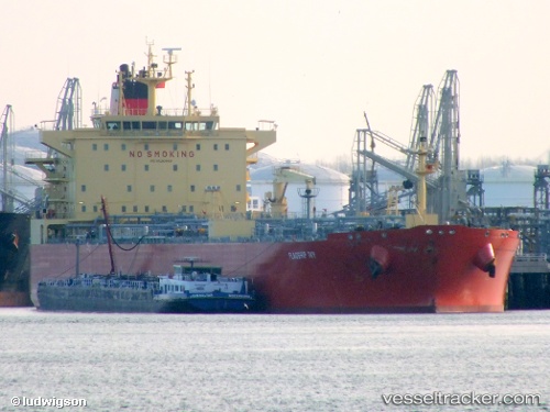
Vessel Flagship Ivy IMO: 9520869, MMSI: 538004854 Oil Products Tanker
UTC, 19.34500, 135.84332, course: -1, speed: 11
UTC, 18.84500, 136.11501, course: -1, speed: 12
2026-02-13 06:08:49 UTC, 18.50667, 136.29666, course: -1, speed: 12
Live AIS position:
UTC. Open sea (no nearby ports in database)),
updated 2026-02-13 06:08:49 UTC.
Find the position of the vessel Flagship Ivy on the map. The latter are known coordinates and path.
marine traffic ship tracker show on live map
The current position of vessel Flagship Ivy is 18.50667 lat / 136.29666 lng. Updated: 2026-02-13 06:08:49 UTCDetails:
Last coordinates of the vessel:
UTC, 19.76500, 135.60834, course: -1, speed: 12UTC, 19.34500, 135.84332, course: -1, speed: 11
UTC, 18.84500, 136.11501, course: -1, speed: 12
2026-02-13 06:08:49 UTC, 18.50667, 136.29666, course: -1, speed: 12