 vesseltracker.com
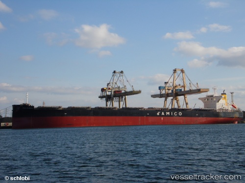
Vessel CIELO D EUROPA IMO: 9539286, MMSI: 636021602 Bulk Carrier
UTC, 1.33312, 104.26971, course: 299, speed: 0.1
UTC, 1.33091, 104.26596, course: 34, speed: 0
2026-02-15 11:26:00 UTC, 1.33187, 104.26514, course: 56, speed: 0.2
Live AIS position:
UTC. Near PENGERANG),
updated 2026-02-15 11:26:00 UTC.
Find the position of the vessel CIELO D EUROPA on the map. The latter are known coordinates and path.
marine traffic ship tracker show on live map
The current position of vessel CIELO D EUROPA is 1.33187 lat / 104.26514 lng. Updated: 2026-02-15 11:26:00 UTCCurrently sailing under the flag of Liberia
CIELO D EUROPA built in 2016 year
Deadweight:
117378 tDetails:
Last coordinates of the vessel:
UTC, 1.33493, 104.26999, course: 258, speed: 0UTC, 1.33312, 104.26971, course: 299, speed: 0.1
UTC, 1.33091, 104.26596, course: 34, speed: 0
2026-02-15 11:26:00 UTC, 1.33187, 104.26514, course: 56, speed: 0.2