 vesseltracker.com
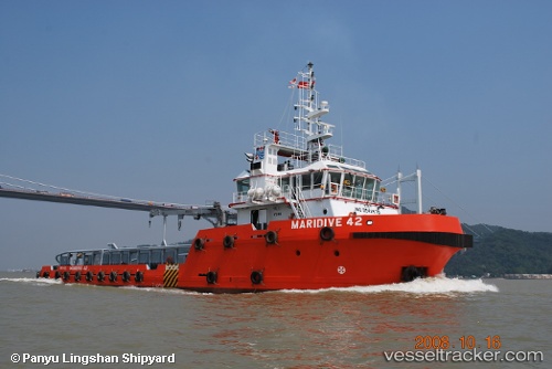
Maridive 42
Current StatusWhere is the vessel?
Maridive 42 is currently in Near KHAFJI, based on AIS data received about 2h ago.
Latest AIS update:
Current position: 28.43883° N, 48.54588° E (Near KHAFJI)
Average speed (last 7 days): Loading…
Average speed (last 30 days): Loading…
Vessel profile: Maridive 42 is a Offshore Tug Supply Ship with dimensions 15m x 50m.
This page combines live AIS, route history, probable destination signals, nearby traffic, and port activity for practical vessel monitoring.
The current position of vessel Maridive 42 is 28.43883 lat / 48.54588 lng. Updated: 2026-03-25 16:10:29 UTCNearest reference points:
- Near KHAFJI
- Near Mina Al Zour
- Near Bandar Al Mishab
Details:
Live Vessel Maridive 42 Analytics (details, animations, etc.)
Recent AIS points (UTC):
2026-03-25 10:14:58 UTC · 28.43858, 48.54639 · SOG 0.1 kn · COG -1°2026-03-25 10:19:59 UTC · 28.43857, 48.54641 · SOG 0.1 kn · COG -1°
2026-03-25 14:10:19 UTC · 28.43871, 48.54602 · SOG 0.1 kn · COG -1°
2026-03-25 16:10:29 UTC · 28.43883, 48.54588 · SOG 0.1 kn · COG -1°