 vesseltracker.com
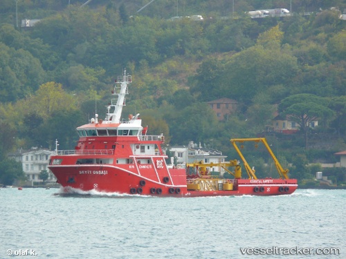
Vessel Seyit Onbasi IMO: 9544451, MMSI: 271042584 Pollution Control Vessel
UTC, 40.81263, 29.29653, course: 293, speed: 0
UTC, 40.81262, 29.29653, course: 293, speed: 0
2026-03-24 17:18:59 UTC, 40.81263, 29.29652, course: -1, speed: 0
Live Vessel Seyit Onbasi Analytics (details, animations, etc.)
Live AIS position: UTC. Near Tuzla Free Zone), updated 2026-03-24 17:18:59 UTC.Find the position of the vessel Seyit Onbasi on the map. The latter are known coordinates and path.
marine traffic ship tracker show on live map
The current position of vessel Seyit Onbasi is 40.81263 lat / 29.29652 lng. Updated: 2026-03-24 17:18:59 UTCCurrently sailing under the flag of Turkey
Seyit Onbasi built in 2011 year
Details:
Last coordinates of the vessel:
UTC, 40.81263, 29.29652, course: 293, speed: 0UTC, 40.81263, 29.29653, course: 293, speed: 0
UTC, 40.81262, 29.29653, course: 293, speed: 0
2026-03-24 17:18:59 UTC, 40.81263, 29.29652, course: -1, speed: 0