 vesseltracker.com
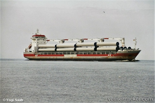
Vessel Thamesborg IMO: 9546459, MMSI: 246887000 Multi Purpose Carrier
UTC, 40.45167, 27.15667, course: -1, speed: 0
UTC, 40.45167, 27.15667, course: -1, speed: 0
2026-03-25 00:28:52 UTC, 40.45167, 27.15667, course: -1, speed: 0
Live Vessel Thamesborg Analytics (details, animations, etc.)
Live AIS position: UTC. Near Icdas Jetty), updated 2026-03-25 00:28:52 UTC.Find the position of the vessel Thamesborg on the map. The latter are known coordinates and path.
marine traffic ship tracker show on live map
The current position of vessel Thamesborg is 40.45167 lat / 27.15667 lng. Updated: 2026-03-25 00:28:52 UTCCurrently sailing under the flag of Netherlands
Thamesborg built in 2013 year
Deadweight:
21359 tDetails:
Last coordinates of the vessel:
UTC, 40.45167, 27.15667, course: -1, speed: 0UTC, 40.45167, 27.15667, course: -1, speed: 0
UTC, 40.45167, 27.15667, course: -1, speed: 0
2026-03-25 00:28:52 UTC, 40.45167, 27.15667, course: -1, speed: 0